
El Niño Southern Oscillation (ENSO) Ocean Indicator
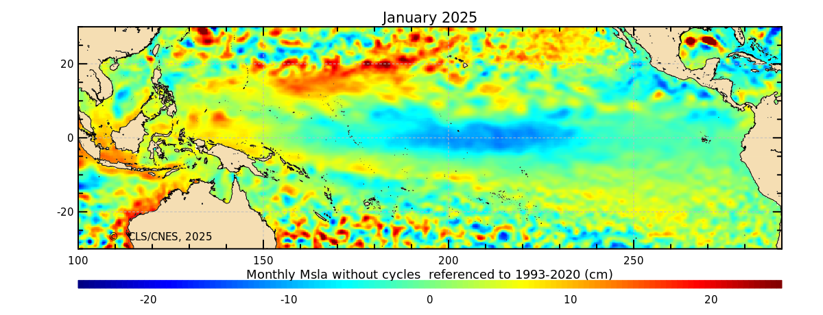
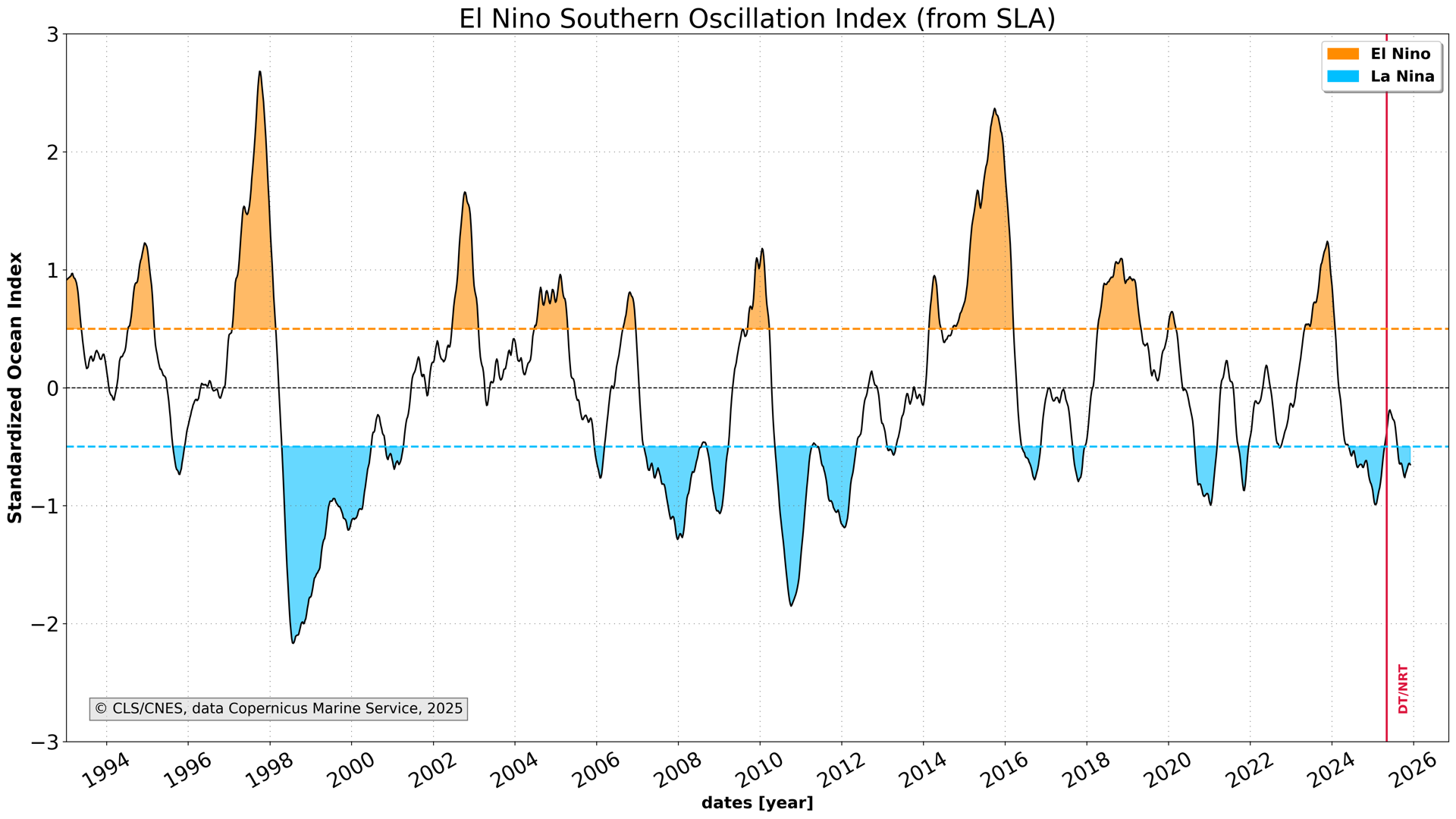
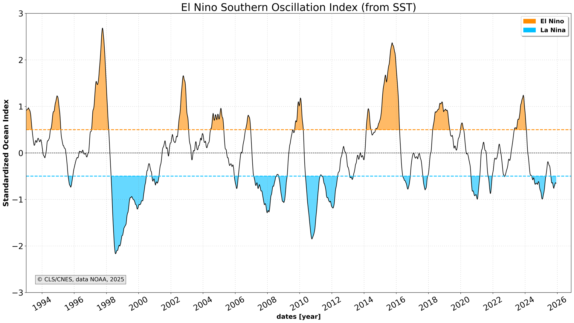
The ENSO (El Niño Southern Oscillation) index is based on the altimeter sea level anomalies over the Nino3.4 region in the Pacific ocean. The annual, seasonal cycles and 60-day signal have been filtered out and the sea level trend has been removed. Monthly time series are computed and normalized.
Données et ressources
-
HTML Ouvrir
-
Product User Manual (handbook)PDF Ouvrir
-
HTML Ouvrir
-
Latest map of Sea Level AnomalyPNG Ouvrir
-
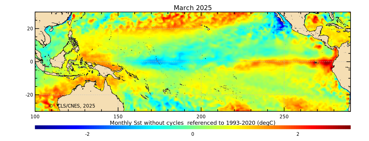
Latest map of Sea Surface TemperaturePNG Ouvrir
-
Previous maps of Sea level Anomaly and Sea surface TemperatureHTML Ouvrir
-
Latest Index of El Niño Southern Oscillation from Sea Level AnomalyPNG Ouvrir
-
Latest Index of El Niño Southern Oscillation from Sea Surface TemperaturePNG Ouvrir
-
HTML Ouvrir
Informations supplémentaires
| Étendue temporelle | 1993-01-01 – en cours |
|---|---|
| Date (creation) | 2015-11-22 |
| Date (lastUpdate) | 2020-01-07 |
| Date (lastUpdate) | 2022-04-10 |
| Date (publication) | 2025-10-13 |
| Date (lastUpdate) | 2025-11-27 |
| Statut | onGoing |
| Fréquence de mise à jour | asNeeded |
| Langue des métadonnées | en |
| Licence | None |
| Métadonnées sources | ISO 19115 XML |
| Dernière mise à jour | 2026-11-04 |
| Créé | 2026-11-04 |
| API | package_show |